
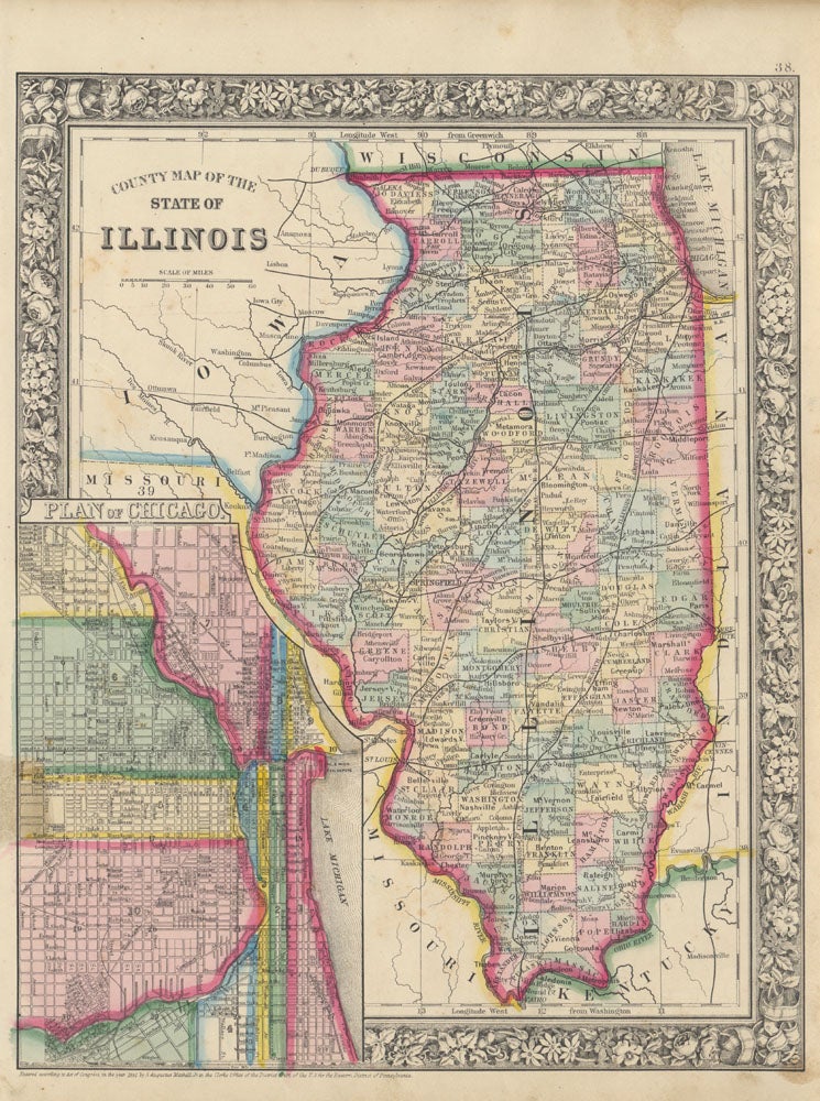
County Map of the State of Illinois.
Philadelphia: S. Augustus Mitchell, Jr., 1864. Folio (12¼" X 15¼", image area 10 3.4" X 13½"). Hand colored. Very good. Borders a bit age toned; inoffensive 1" faint stain at lower left margin. Item #46861
Sharp, brightly colored map of the Land of Lincoln, from the 1864 edition of "Mitchell's New General Atlas, Containing Maps of the Various Countries of the World, Plans of Cities, Etc." Large inset at lower left shows "Plan of Chicago." Nicely colored, with bold decorative border. Accompanied by the original worn title page (only) of this volume, bearing large ownership signature at upper right of Asa McFarland Abbott (1820-89). The home of this gunsmith and pioneering farmer of Morrison, Illinois (which appears at upper left, county seat of Whiteside County in the northwest) was a well-documented Underground Railroad site; he was related to Olive Oatman Fairchild (1837-1903), whose family left the farm next door to emigrate to California in 1850 and were attacked enroute by Native Americans -- the famous "Oatman Massacre." Olive was enslaved and tatooed and later penned a bestselling account of her captivity.
Price: $150.00