
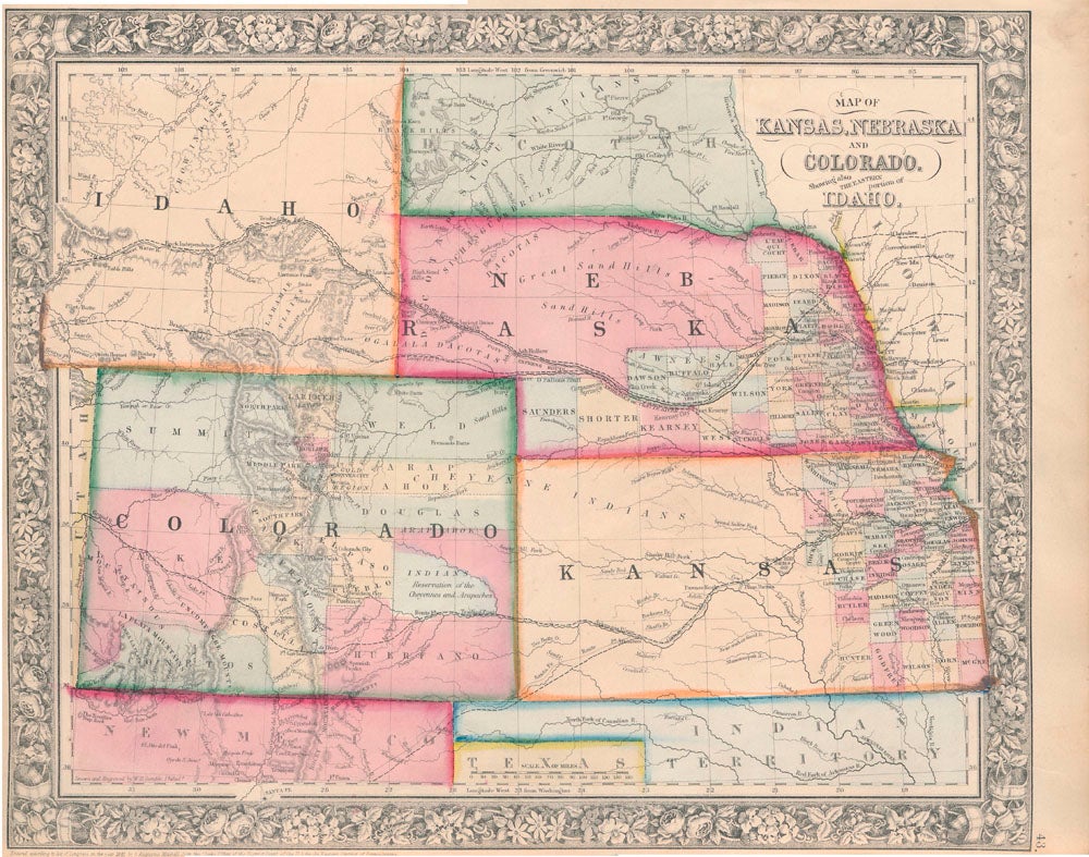
Map of Kansas, Nebraska and Colorado Showing Also the Eastern Portion of Idaho.
New York: S. Augustus Mitchell, Jr., 1861. Folio (15¼" X 12¼", image area 14" X 11½"). Hand colored. Very good. Mild age toning. Item #45497
Attractive, clean-edged example of this pleasingly-colored multi-state map, from the 1864 edition of "Mitchell's New General Atlas, Containing Maps of the Various Countries of the World, Plans of Cities, Etc." Handsome decorative floral border and handsome original colors make for a striking image.
Price: $175.00
See all items in
Maps
See all items by KANSAS -- NEBRASKA -- COLORADO -- IDAHO -- Map