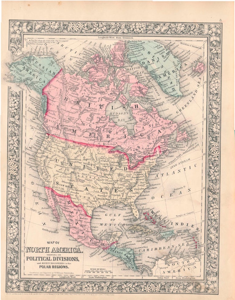
Map of North America Showing Its Political Divisions, and Recent Discoveries in the Polar Regions.
New York: S. Augustus Mitchell, Jr., 1860. Folio (12¼" X 15", image area 10½" X 13½"). Hand colored. Very good. Faint age toning only. Item #45491
Bright and handsome example of this softly-colored continent map, from the 1864 edition of "Mitchell's New General Atlas, Containing Maps of the Various Countries of the World, Plans of Cities, Etc." Canada is labeled "British America" and Alaska is "Russian America," while tiny asterisk at upper left denotes "This line shows the route of the Ship Investigator Capt. McClure on the Discovery of the Northwest Passage." Bold decorative border. A fine example.
Price: $100.00
See all items in
Maps
See all items by NORTH AMERICA -- Map