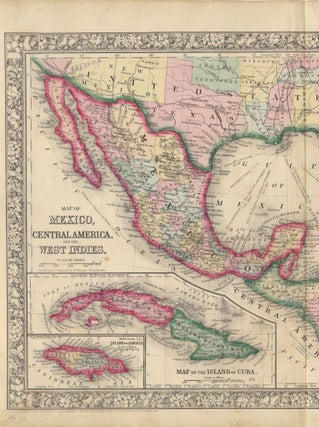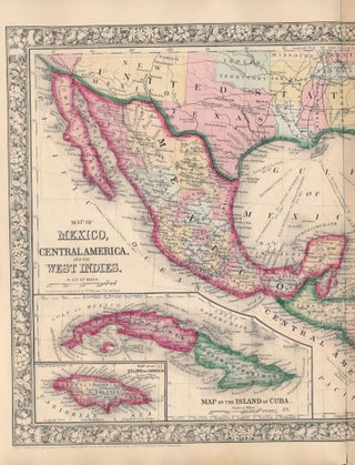
Map of Mexico, Central America, and the West Indies.
New York: S. Augustus Mitchell, Jr., 1860. Folio (23½" X 15¼", image area 21¼" X 13¼"). Hand colored. Very good. Lightly age toned, with single vertical fold (as issued). Bright and fetching centerfold map of this large region, from the 1864 edition of "Mitchell's New General Atlas, Containing Maps of..... More