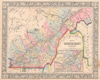
Map of Canada East in Counties / Map of Canada West in Counties.
New York: S. Augustus Mitchell, Jr., 1860. Each folio (15¼" X 12¼", image areas 13¼" X 10½"). Hand colored. Very good. Slightly age toned, with minor soiling. Handsome pair of maps of Canada's eastern counties and what was then her western counties, from the 1864 edition of "Mitchell's New General..... More