
The World in Hemispheres. With Other Projections &c. &c.
New York: S. Augustus Mitchell, Jr., 1860. Folio (15¼" X 12¼", image area 13" X 11"). Hand colored. Very good. Some age toning and faint soiling. Item #46975
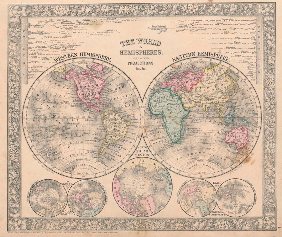
Delicately colored example of this world map, from the 1864 edition of "Mitchell's New General Atlas, Containing Maps of the Various Countries of the World, Plans of Cities, Etc." Centered below the "Western Hemisphere" (at left) and "Eastern Hemisphere" (at right) is a smaller "North Polar Region," while four even smaller spheres depict "The World on a Polar Projection" and "Land and Water Hemispheres." Near the top are depicted the world's great rivers tiered according to length above their appropriate hemisphere -- thus the Mississippi River at top above the Western Hemisphere and the Yang tse kiang River above the Eastern Hemisphere. Sharp floral border, nice original colors.
Price: $100.00