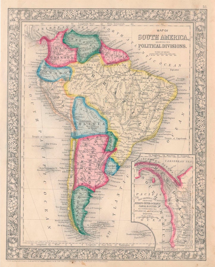
Map of South America, Showing Its Political Divisions.
New York: S. Augustus Mitchell, Jr., 1860. Folio (12¼" X 15¼", image area 10½" X 13½"). Hand colored. Near fine. Light age toning and faint soiling. Item #46957
Nice, bold map of this continent, from the 1864 edition of "Mitchell's New General Atlas, Containing Maps of the Various Countries of the World, Plans of Cities, Etc." Inset at lower right contains the intriguing "Map Showing the Proposed Atrato-Inter-Oceanic Canal Routes, for Connecting the Atlantic and Pacific Oceans" -- the future Panama Canal. "Patagonia" at the southern tip is of course present, and today's Colombia shows New Granada. Well colored, with fine floral border.
Price: $85.00
See all items in
Maps
See all items by SOUTH AMERICA -- Map