
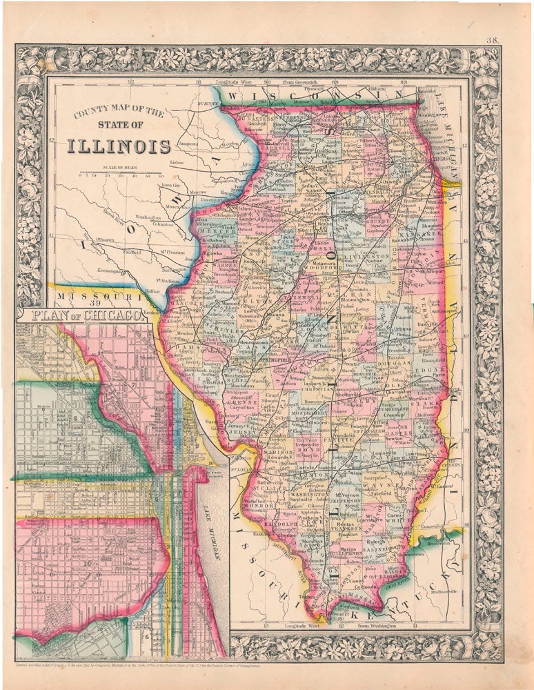
County Map of the State of Illinois.
New York: S. Augustus Mitchell, Jr., 1861. Folio (12¼" X 15¼", image area 10 3/4" X 13½"). Hand colored. Very good. Light age toning only. Item #45498
Quite handsome example of this richly-colored multi-state map, from the 1864 edition of "Mitchell's New General Atlas, Containing Maps of the Various Countries of the World, Plans of Cities, Etc." At lower left is a large "Plan of Chicago" vignette featuring a detailed map of that city in its Civil War-era appearance. Bold decorative floral border.
Price: $125.00
See all items in
Maps
See all items by ILLINOIS -- Map