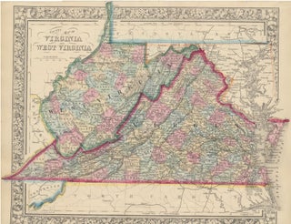
County Map of Virginia and West Virginia.
New York: S. Augustus Mitchell, Jr., 1863. Folio (15¼" X 12¼", image area 14¼" X 11 3/4"). Hand colored. Very good. Faint age toning. Wonderfully richly and nicely colored map of these two side-by-side southern states, published the same year that this breakaway state achieved statehood. From the 1864 edition..... More