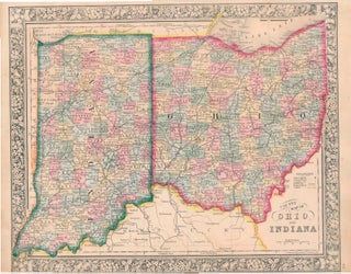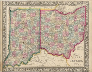
County Map of Ohio and Indiana.
New York: S. Augustus Mitchell, Jr., 1864. Folio (15¼" X 12¼", image area 14" X 11½"). Hand colored. Very good. Some age toning. Extensively colored map of these two side-by-side Midwest states, from the 1864 edition of "Mitchell's New General Atlas, Containing Maps of the Various Countries of the World..... More