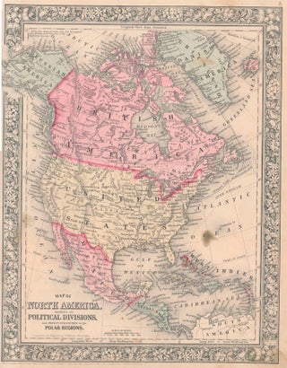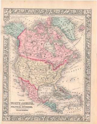
Map of North America Showing Its Political Divisions, and Recent Discoveries in the Polar Regions.
New York: S. Augustus Mitchell, Jr., 1860. Folio (12¼" X 15", image area 10½" X 13½"). Hand colored. Very good. Faint age toning only. Bright and handsome example of this softly-colored continent map, from the 1864 edition of "Mitchell's New General Atlas, Containing Maps of the Various Countries of the..... More